Location
Mount Vernon, WA 98274
Location
Mount Vernon, WA 98274

Stretching between land and sea, saltmarshes form a silent buffer that protects coastal communities, captures carbon, and nurtures biodiversity. From community-driven planting to drone mosaics of newly restored flats, these tidal wetlands are emerging as climate champions.
At dawn, the horizon glows pink over a tidelands restoration site on the Atlantic coast. Volunteer teams wade ankle-deep through cordgrass seedlings, their boots sinking gently into soft peat. Each sprig they plant will one day stand guard against storm surges, anchoring sediment and absorbing wave energy. This scene is part of a growing global movement to revive saltmarshes-those sprawling wetland carpets where the tides whisper secrets about resilience, carbon storage, and living coastal defenses.
Once dismissed as wastelands, saltmarshes have entered the scientific spotlight as unsung heroes in the fight against climate change. A recent review published in Marine Ecology Progress Series estimates that saltmarsh soils can sequester up to four times more carbon per hectare than most temperate forests. Beyond carbon capture, these ecosystems reduce coastal flooding by up to 50 percent in some regions, filtering pollutants and nurturing rich food webs for fish, shorebirds, and invertebrates.
But decades of land reclamation, dredging, and sea-level rise have left many marshes fragmented or buried beneath development. Restoring them demands more than planting cordgrass; it requires careful hydrological re-engineering, close monitoring, and collaboration with local communities who live with the tides every day.
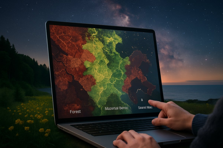
Along the Dutch Wadden Sea-an ever-shifting barrier of islands and saltflats-engineers have reshaped dikes to let seawater flood old polders at high tide. Narrow channels carve new drainage paths, reestablishing natural ebb and flow. Within months, millions of halophyte seedlings begin to carpet the mud. Satellite data from the European Space Agency’s Sentinel-2 constellation reveals a visible transformation: dull gray flats shift to vibrant green, signaling the return of photosynthetic life and carbon-trapping meadows.
On the U.K.’s east coast, community groups gather for weekend planting festivals. Children learn to float marsh plants in trays, lining up the stems before gently pressing them into tidal soils. Elders share family stories of shrimps and crabs, passed down through generations. Local councils provide lightweight GPS units so volunteers can plot each planting location. Over time, these georeferenced records feed into an open-access database for researchers tracking growth rates, sediment accretion, and the local economic benefits as fisheries rebound.
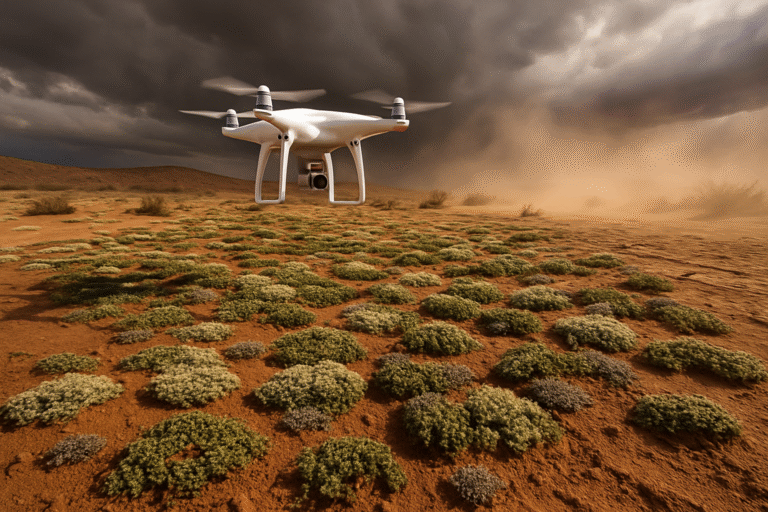
In the southeastern United States, one restoration project has embraced a hybrid approach of citizen science and machine learning. Volunteers place low-cost sensor arrays across mudflats to measure temperature, salinity, and water depth. Drones equipped with multispectral cameras fly weekly transects, capturing high-resolution images of vegetation cover. A cloud-based algorithm stitches these images into time-lapse mosaics, detecting stress signals in young plants and warning managers where to adjust tidal gates or redistribute sediment.
Early results are promising: within two years, restored plots show 30 percent higher sediment elevation compared to control sites. That gain translates into a measurable reduction in flood peaks during spring tides, according to hydrodynamic models calibrated with local data. As saltmarshes build their own critical “land height,” they can keep pace with moderate sea-level rise without additional reclamation efforts.
But no single technology or protocol fits every coastline. Restoration practitioners emphasize the importance of understanding local geology, tidal amplitudes, and species mixes. In the Gulf of Mexico, for instance, Spartina alterniflora reigns supreme, but hybrid cordgrass varieties can show higher tolerance to variable salinity. In cooler channels of northern Europe, Puccinellia maritima and Salicornia europaea succeed where subtropical species would struggle.
Mapping these ecological niches often begins with soil cores and field surveys, but remote sensing is rapidly democratizing the process. Hand-held spectrometers can identify saltmarsh plant signatures on site. Satellite thermal bands detect water-logged areas that might drown young seedlings in unprotected flats. Machine-learning tools parse these data layers, generating site-specific recommendations for channel design, planting densities, and succession timelines.
Equally critical is local buy-in. In small fishing communities, marsh restoration can open new economic pathways: eco-tourism trails on boardwalks, sustainable shrimp farming among tidal pools, or carbon credits sold through regional trading schemes. Several projects in Louisiana have integrated saltmarsh corridors into levee networks, allowing controlled inundation that builds land while maintaining flood protection for nearby towns.
Emotional intelligence plays a subtle yet vital role in these partnerships. Restoration teams spend as much time listening to fisherfolk’s deep understanding of tides as they do analyzing lab results. They host potluck dinners where elders taste new marsh grasses and share memories of vanished oyster beds. Such rituals foster mutual respect and ensure that coastal stewardship feels like a collective celebration rather than an outsider’s intervention.
Amid rising seas and intensifying storms, saltmarshes offer a nature-based solution that blends ancient processes with modern insights. They transform saline inundation from a destructive force into a regenerative one, capturing sediment and carbon in a self-reinforcing cycle. For climate-vulnerable shores, restoring these wetlands means inviting the tide to do the work-protecting communities, supporting livelihoods, and kindling biodiversity.
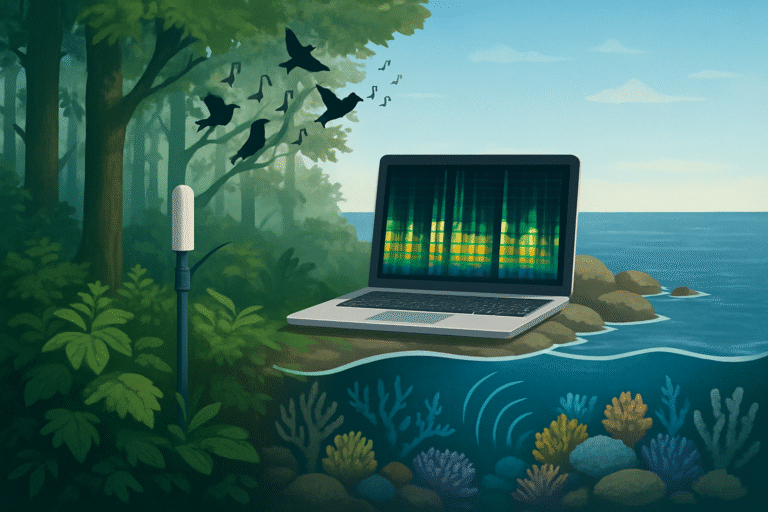
As dusk falls over one restored site, bioluminescent plankton begin to glow where the mud meets the water. Tiny sparks trace the path of waves against the flats, a quiet testament to the living system beneath. Volunteers gather to watch as egrets return to forage and luminescent ripples dance under a rising moon. It’s a scene that speaks of renewal, reminding us that when people and nature collaborate, resilience emerges from the waterlogged ground itself.
Beyond the concrete seawalls and engineered levees, saltmarshes stand ready to teach us how to adapt-one cordgrass stem, one tidal pulse, one community-drawn plan at a time.